
THIS is the creepy Google Maps spot in Warrington where you can find ‘zombies’.
It may not be what you are expecting to find when searching for historic Daresbury Hall on Google Maps.
But when using the interactive ‘drop in’ mode, you’ll be greeted by creepy blood-stained men at this location as the service allows you to look inside the abandoned building.
It shows the historic hall - which was built in 1759 - splattered in blood.
Sinister messages are graffitied throughout the building, including ‘no hope left’, ‘leave now’ and ‘don’t trust the American’.
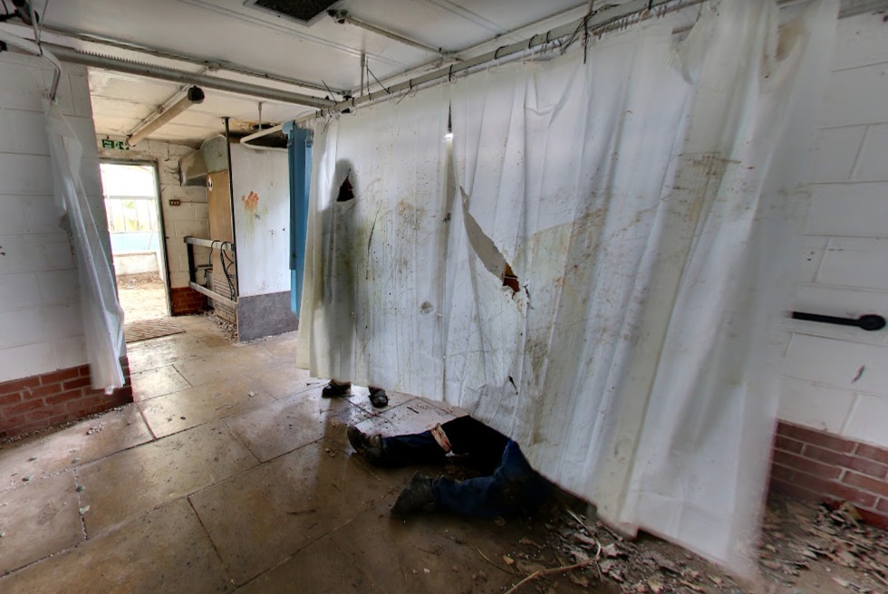
Picture: Google Maps
And there are also slumped over and ‘dead’ men or 'Zombies' at different spots throughout the abandoned hall - including in what looks like a former swimming pool.
Before a huge fire gutted Daresbury Hall, the building was used as a ‘Zombie Manor House’ by event company Zed Events, explaining its eerie Google Maps images.
It was used to host zombie survival games.
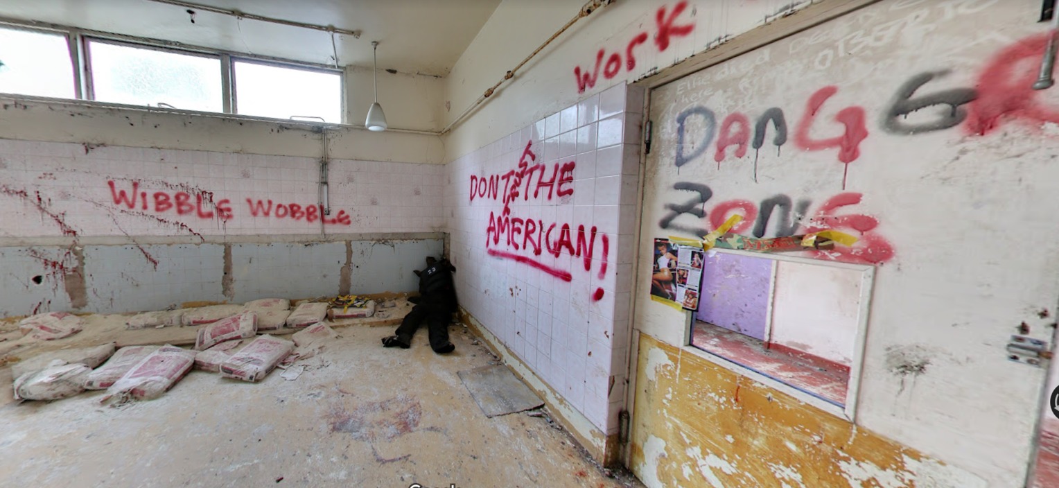
Picture: Google Maps
Before this, the hall had been used as a residential home by the charity now known as Scope for a number of years from 1955.
It was then bought by a millionaire who planned to restore it – but he died before plans could be realised.
And in April 2021, the Warrington Guardian reported that Daresbury Hall was at risk of being lost forever.
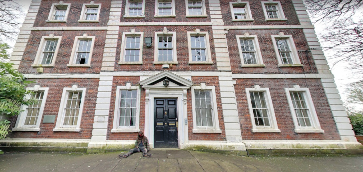
Picture: Google Maps
This was according to Historic England’s 'Heritage at Risk' Register, which lists historic buildings in desperate need of repair.
Since the fire that destroyed most of the interior, the site has been secured but Historic England describes the building as having 'large amounts of masonry in an unstable condition'.
The at risk register entry added: “The building has been secured with a facade retention scaffold and mothballed in a roofless condition. Some urgent works are necessary to ensure complete loss is averted.”
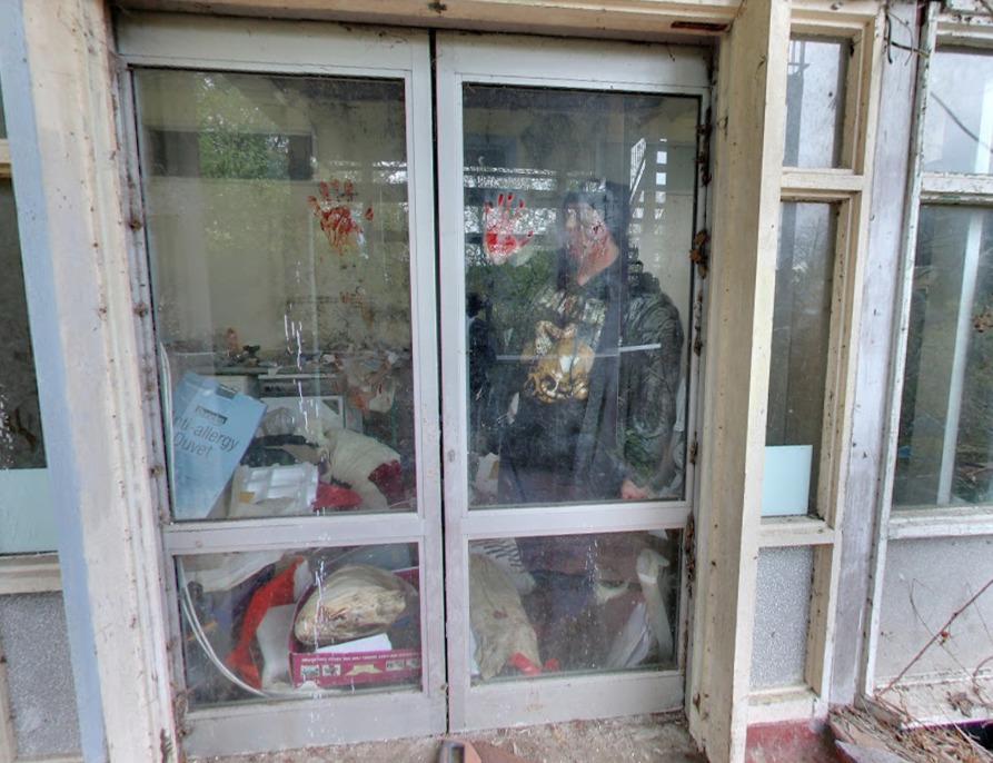
Picture: Google Maps


Comments: Our rules
We want our comments to be a lively and valuable part of our community - a place where readers can debate and engage with the most important local issues. The ability to comment on our stories is a privilege, not a right, however, and that privilege may be withdrawn if it is abused or misused.
Please report any comments that break our rules.
Read the rules hereLast Updated:
Report this comment Cancel